Seeing Our Future Sea
As climate change continues to rear its head in numerous ways including extreme weather, wildfires, heat waves, more destructive hurricanes, etc., the natural phenomenon of King Tides is also being influenced by a changing climate.
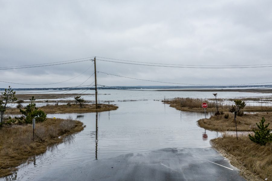
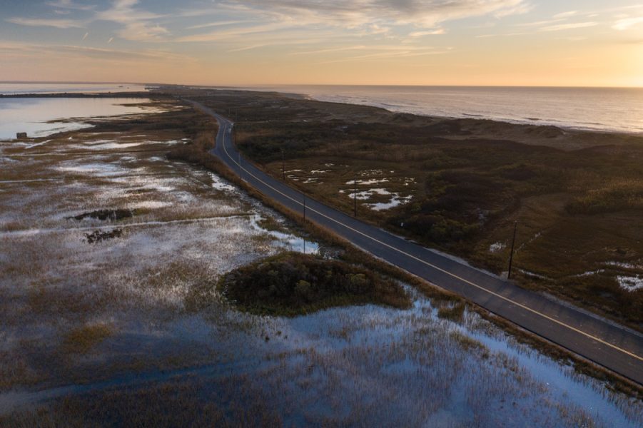
Photo / Bobby Alan
What's a King Tide?
Put simply, King Tides are the highest high tides of the year. They naturally occur a few times a year when the moon, sun and earth gravitationally align to cause a higher and more dramatic tide than normal. When these factors occur simultaneously, a King Tide can flood roads, houses, industrial sites and communities. Nationwide king tides can provide a sneak-peek into how future sea level rise will impact our coastal communities.
Monitoring King Tide events is important to us here at Surfrider Foundation's Eastern Long Island Chapter because they give us an indication of where sea level rise will have the greatest and most immediate impact in the form of flooding on our local coastlines. Our chapter has begun photo documenting the tides each time they occur.
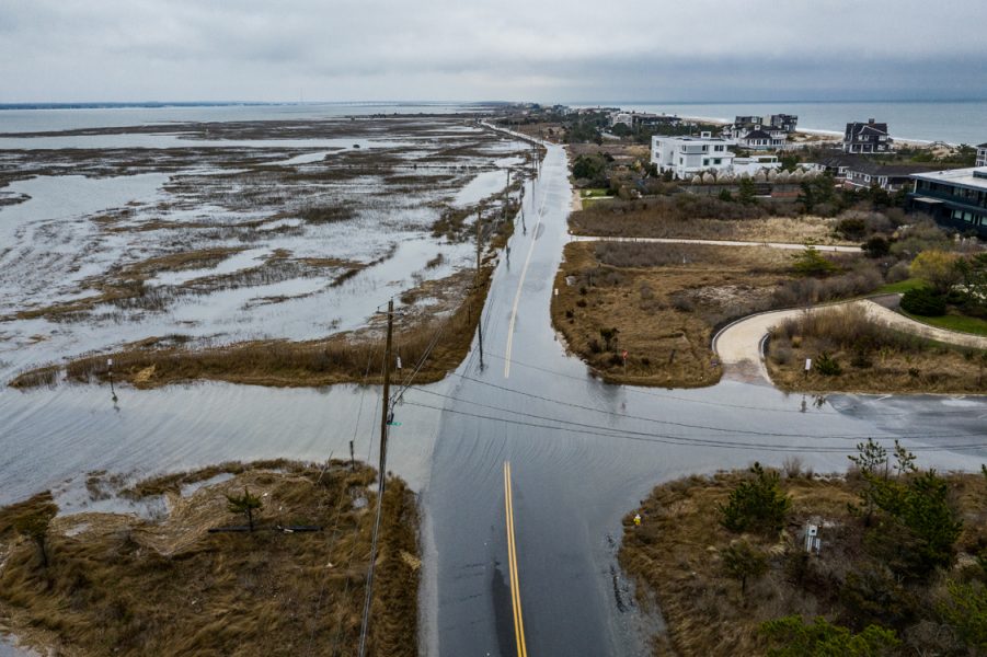
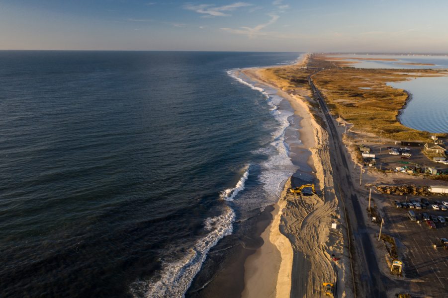
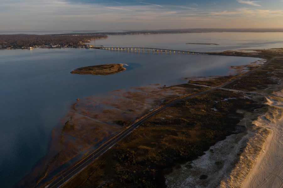
Photo / Bobby Alan
“Better understanding what future sea level rise might look like for coastal communities is imperative,” said Surfrider’s Coastal Preservation Manager, Stefanie Sekich-Quinn. “Over the next 30 years, nearly 300,000 homes and commercial properties in the U.S., valued at over $136 billion, will be vulnerable to sea level rise. Unfortunately, more than half of coastal states nationwide have continued to build in risky, flood-prone areas over the past decade. We are hopeful our King Tide documentation will inspire decision-makers and local communities to improve coastal management in light of future climate change impacts.”
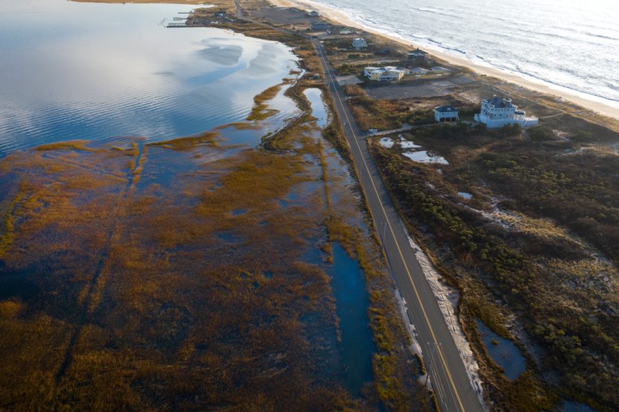
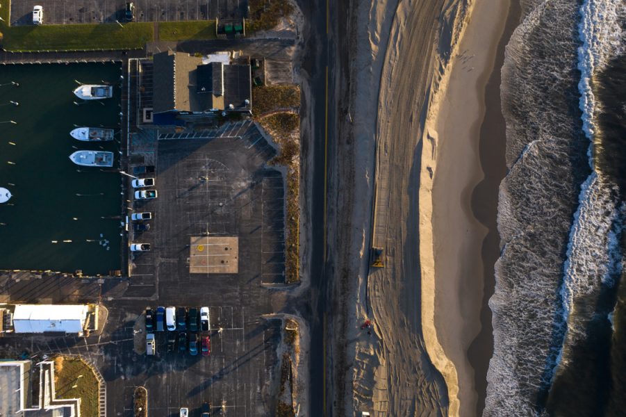
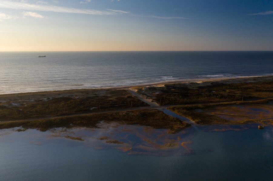
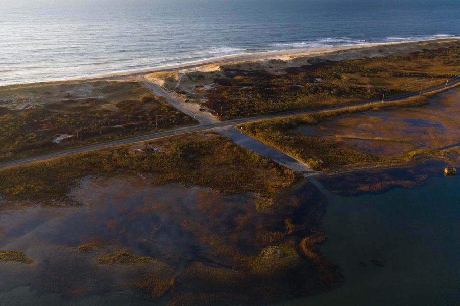
While we included pictures illustrating homes and roads threatened by the abnormally large tides on Dune Road in the Hampton Bays / East Quogue area, we also included a few pictures that illustrate how dunes and open space can accommodate larger tides. Demonstrating the point that coastlines left in their natural condition are often the best defense against rising seas.
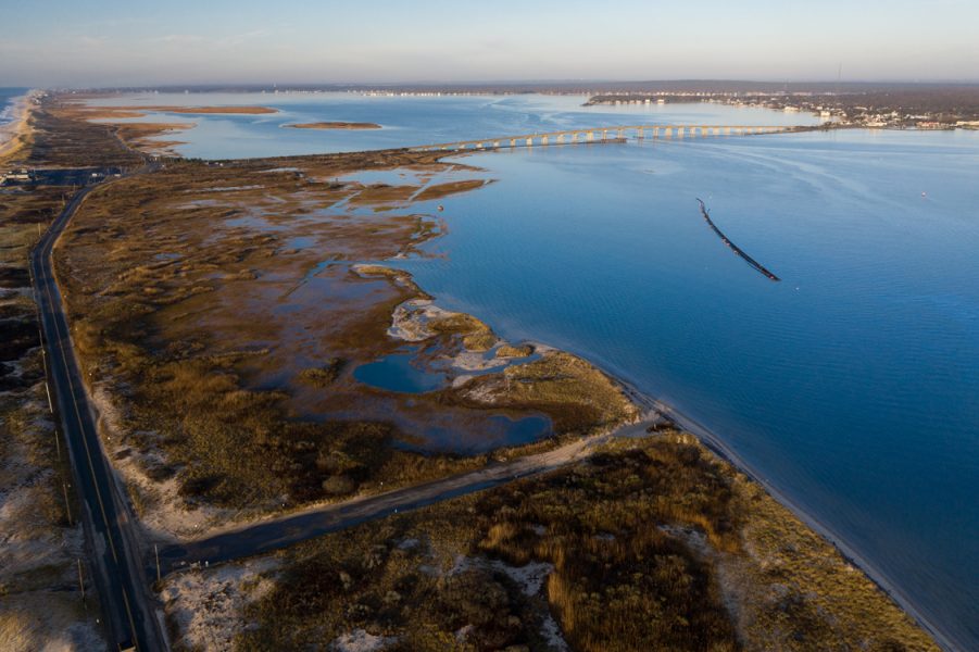
Photos / Bobby Alan
Given the stark reality of climate change impacts, it’s imperative that coastal communities double down on proactively planning for sea level rise —especially when considering that nearly 40% of Americans live within the coastal zone. In fact, a report from Union for Concerned Scientists concluded that in the next 30 years, 300,000 homes and commercial properties, worth $136 billion dollars, will be vulnerable to sea level rise. Another report conducted by Zillow found there has been a nationwide trend over the past decade where nearly half of all coastal states continue to build in flood prone areas. Finally, the Surfrider Foundation’s State of the Beach Report found that nearly 75% of coastal and Gulf of Mexico states are not prepared for future sea level rise.
For more information on rising seas and climate change impacts, view Surfrider’s State of the Beach Report or visit Surfrider.org.
For more about Surfrider Foundation's coverage of nationwide King Tides visit Surfrider and LightHawk Join Forces During King Tides for Glimpse into Future Sea Level Rise
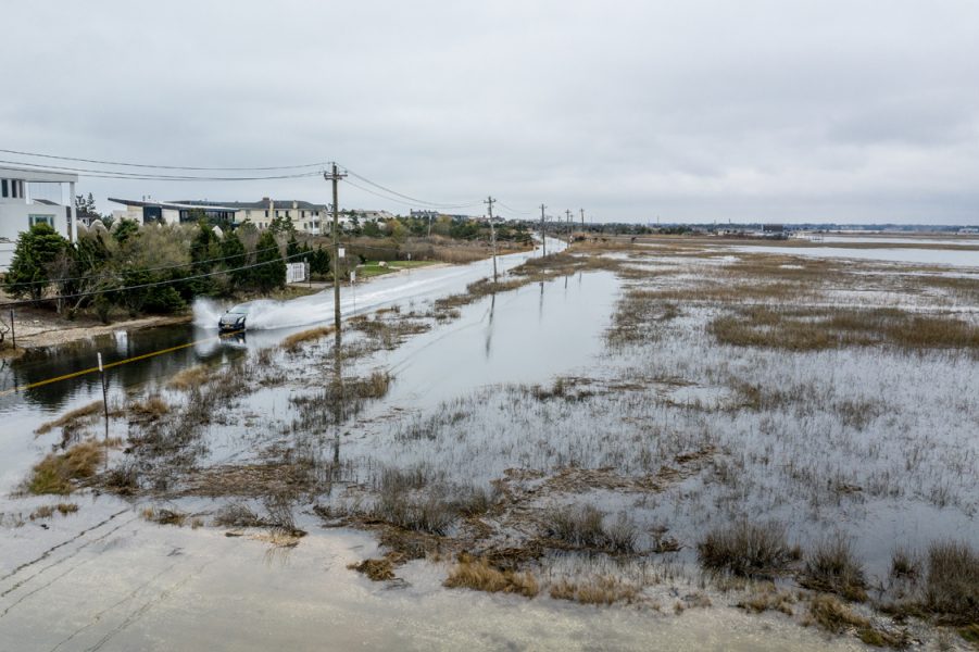
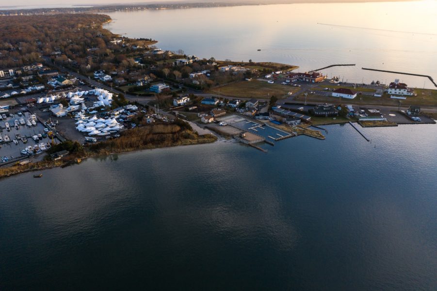
Photo / Bobby Alan
2020 EAST COAST UPCOMING KING TIDES
- April 8 - 10
- May 6 - 9
- June 4 - 6
- October 12 - 20
- November 13 - 18
- December 13 - 16
Photos / Bobby Alan